
Cnoc Cruach an Chuilinn [Croaghacullion]
Good walks are even better shared.
Overview
Cnoc Cruach an Chuilinn [Croaghacullion]
Nestled in the beautiful surroundings of Northern Ireland's Sperrin Mountains, Cnoc Cruach an Chuilinn is a splendid Marilyn peak that offers both challenging hikes and breathtaking views. Standing at 417 meters, it's not the tallest peak around, but don’t let that fool you; it has its own unique allure.
Geology
This mountain is primarily shaped from metamorphic schists, sculpted by ancient glaciers that once roamed these hills. Can you feel the history beneath your feet? It’s like walking on a geological timeline!
Routes
The main route to the summit is the Cnoc Cruach an Chuilinn Loop, a delightful journey that covers approximately 6.5 km. It typically takes about 2.5 hours to complete, making it accessible for those with moderate experience. This loop will take you through enchanting scenery, blending grassy patches and rocky outcrops, all while you dodge the occasional boggy section (just consider it a full body workout!).
Summit Features
Reaching the summit, you will encounter a charming stone cairn. It’s the perfect spot to catch your breath and appreciate the panoramic views around you. Don’t forget to snap a selfie!
Terrain Type
Expect a mix of grassy slopes, rocky outcrops, and a bit of that classic Irish bog. If you fancy an unscheduled mud bath, just wear your best waterproof boots!
Views
From the top, the views are simply stunning. You can marvel at the iconic silhouette of the Sperrin Mountains stretching before you and perhaps spot the Donegal hills in the distance on a clear day. The best seasons for views? Spring and early autumn shine bright with wildflowers and colorful foliage.
Hazards
Be mindful of the weather, which can change more often than a cat on a hot tin roof! The terrain can be slippery, especially in boggy areas, so look before you leap.
Nearby Summits
If you're feeling adventurous, consider tackling nearby peaks like Sawel Mountain (674 meters) or Glenelly Mountain (552 meters). Each offers its own unique challenges and views.
Access
Getting there is straightforward. Limited parking is available along Broughderg road, with a short walk leading to the trailhead. Public transport isn’t the best bet, so a car is advisable.
Facilities
Post-hike, you can find a range of cafes and shops in Broughderg to refuel. Who doesn't enjoy a cup of tea after a good climb?
History
The name Cnoc Cruach an Chuilinn reflects the verdant surroundings, translating to 'Hill of the Stack of the Holly.' This area has held significance throughout history, providing resources and inspiration for tales and legends.
In conclusion, whether you’re drawn by the camaraderie of fellow hikers or the chance to enjoy nature’s beauty, Cnoc Cruach an Chuilinn has something special for everyone. Just remember, it’s not always about the summit; sometimes, the journey is where the real gems are found.
Looking forward to seeing you out there—hiking boots at the ready!
Explore routes near Cnoc Cruach an Chuilinn [Croaghacullion]
Public walks starting within 80 km of this hill. Nearby does not mean a route reaches the summit; check its map and access before setting out.
Route planning notes
These notes describe possible approaches, not verified navigable routes or permission to cross land. Check current paths, local access rules and conditions before setting out.
Cnoc Cruach an Chuilinn Loop
A scenic loop starting from the nearby Broughderg road, providing both ascent and descent across stunning terrain.
Make a day of it, together
Find someone to share the walk with, or organise a day out along a route you like.
Hill facts and local notes
Classifications
Elevation
374m
1,227 ft
Prominence
220m
Coordinates
54.7283, -8.6682
G570869
OS Map
10
At the Summit
The summit features a small stone cairn and offers stunning views across the surrounding hills and valleys.
Terrain & Geology
The mountain is primarily composed of metamorphic rocks, mainly schists, which have been shaped by glacial activity, giving the area its rugged and scenic contours.
Views & Scenery
At the summit, you can view the distinctive silhouette of the Sperrin Mountains, the charm of the rolling countryside, and on a clear day, even the distant Donegal hills.
History & Heritage
Name Origin
Cnoc Cruach an Chuilinn translates to 'Hill of the Stack of the Holly,' reflecting the area's lush flora.
Historical Significance
The Sperrin Mountains, including Croaghacullion, have been significant throughout Irish history, providing natural resources and inspiring folklore.
Getting There & Facilities
Check current local access restrictions, parking rules and transport timetables before travelling. These notes do not confirm public access to the summit.
Parking
There is limited parking available along the Broughderg road, a short walk from the trailhead.
Public Transport
Public transport options are sparse; driving is recommended. Check local bus services for potential routes to nearby villages.
Nearby Facilities
While there are no facilities directly on the mountain, Broughderg and nearby towns offer cafes and shops for refreshments post-hike.
Safety Information
Known Hazards
- Beware of changes in weather; conditions can shift quickly in the mountains. The terrain may be boggy, especially after rainfall, so sturdy footwear is recommended.
General Safety Tips
- Check weather conditions before setting out
- Carry appropriate clothing and equipment
- Let someone know your planned route
- Take a map, compass, and GPS device
- Carry emergency supplies: food, water, first aid kit, torch
Hills
Some common questions about the hills answered
Are there group walks up Cnoc Cruach an Chuilinn [Croaghacullion]?
Many walkers use Walkmates to join or organise walks with others. You can check for group walks around Cnoc Cruach an Chuilinn [Croaghacullion] through the maps
Are there other walkers around Cnoc Cruach an Chuilinn [Croaghacullion]?
Activity varies by location and time, but Walkmates lets you see whether others have shared walks or shown interest in this area. Find other people through the walking friends search walking friends for Cnoc Cruach an Chuilinn [Croaghacullion] search or of course create your own walk for Cnoc Cruach an Chuilinn [Croaghacullion]
Can I organise a walk to Cnoc Cruach an Chuilinn [Croaghacullion]?
Yes. If there aren’t any walks listed already, you can create a walk and make it available for others to join.
If you're signed up to Walkmates, you can create a walk to Cnoc Cruach an Chuilinn [Croaghacullion].
How do I find a walk up this hill?
There are often multiple ways to walk this hill, depending on experience and route preference. Walkmates helps you explore walks and routes that others have shared.
Can I suggest a new route up Cnoc Cruach an Chuilinn [Croaghacullion]?
Yes. You can suggest or create routes to share with others. Walkmates focuses on the social side of walking, so routes are used to help people organise walks and explore areas together, rather than as detailed navigation tools or route libraries.
Other uses really appreciate knowledgeable walkers sharing their routes. Share your favourite route to Cnoc Cruach an Chuilinn [Croaghacullion] here
The is an error or something incorrect about this hill. How do I let you know?
We always strive to keep the information on Walkmates as accurate as possible. If you find an error, please let us know through the contact form and we'll aim to correct it as quickly as possible
Community Discussion
Comments
Location
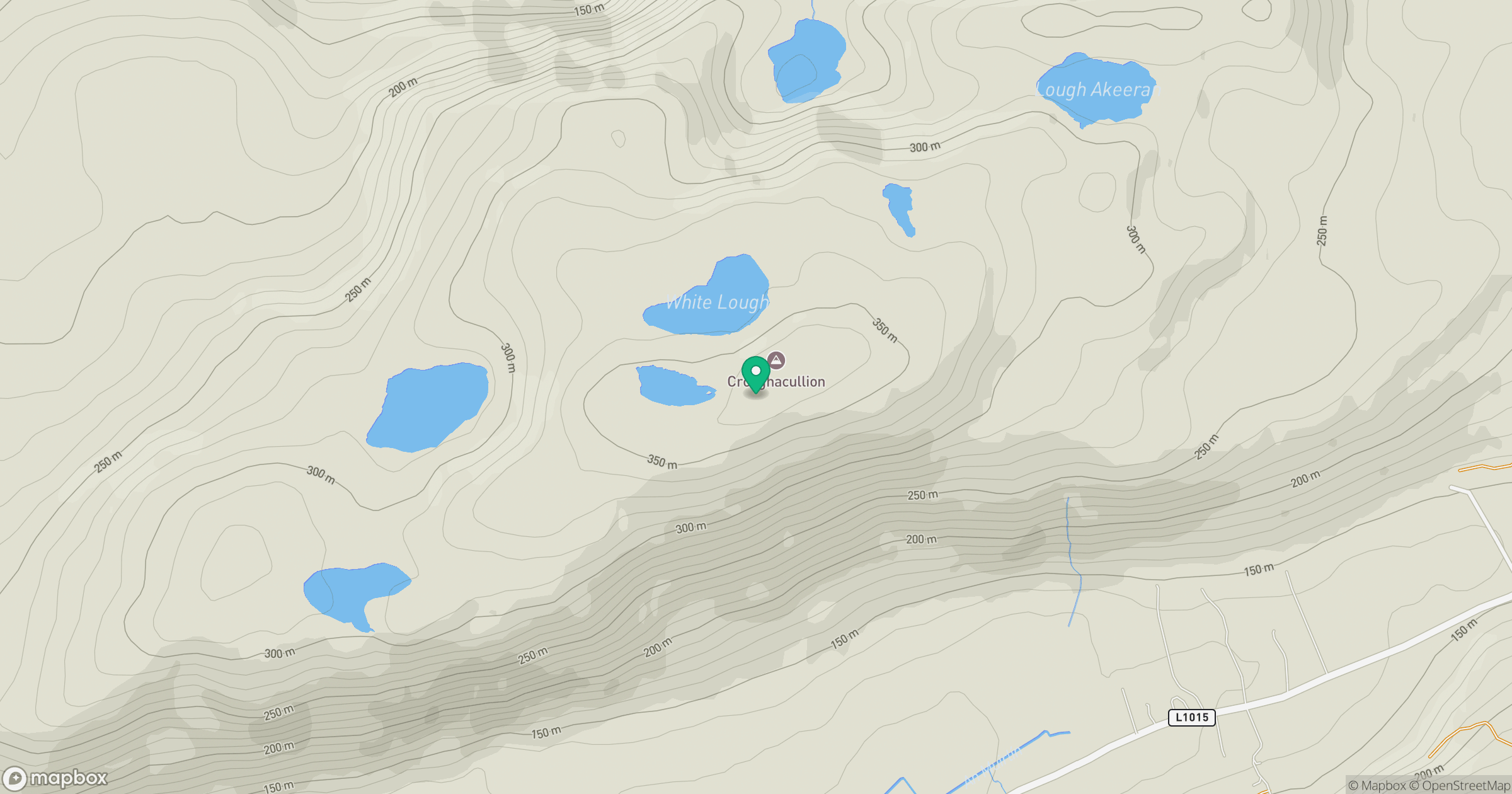
Grid reference: G570869
View on OpenStreetMapOpens a map in a new tab, centred on the hill.
Hills within 30 km
Straight-line distance, not a walking route or confirmation of access.
No comments yet. Be the first.